
Caxambu
Caxambu | |
|---|---|
| Municipality of Caxambu | |
 Flag  Coat of arms | |
| Nickname: Cidade das Águas | |
| Motto(s): Medicina entre flores "Medicine among flowers" | |
 Location in Minas Gerais | |
| Coordinates: 21°58′37″S 44°55′58″W / 21.97694°S 44.93278°W | |
| Country | |
| State | |
| Region | Southeast |
| Intermediate Region | Pouso Alegre |
| Immediate Region | Caxambu-Baependi |
| Founded | 16 September 1901 |
| Government | |
| • Mayor | Diogo Curi Hauegen (PSDB) |
| Area | |
| • Total | 100.203 km2 (38.689 sq mi) |
| Elevation | 895 m (2,936 ft) |
| Population (2021)[2] | |
| • Total | 21,566 |
| • Density | 220/km2 (560/sq mi) |
| Demonym | caxambuense |
| Time zone | UTC−3 (BRT) |
| HDI (2010) | 0.743 – high[3] |
| Website | caxambu |


.jpg)

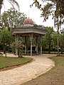
Caxambu is a Brazilian municipality in Minas Gerais. Its population in 2021 was estimated at 21,566.
Caxambu is renowned for its spa which has twelve sources of mineral sparkling water flowing 24 hours a day and a cold-water geyser.[4]
-
 Mineral waters

Climate[edit]
| Climate data for Caxambu (1981–2010) | |||||||||||||
|---|---|---|---|---|---|---|---|---|---|---|---|---|---|
| Month | Jan | Feb | Mar | Apr | May | Jun | Jul | Aug | Sep | Oct | Nov | Dec | Year |
| Mean daily maximum °C (°F) | 28.7 (83.7) |
29.5 (85.1) |
28.6 (83.5) |
27.5 (81.5) |
25.4 (77.7) |
24.1 (75.4) |
24.9 (76.8) |
26.4 (79.5) |
27.2 (81.0) |
28.1 (82.6) |
28.5 (83.3) |
28.3 (82.9) |
27.3 (81.1) |
| Daily mean °C (°F) | 22.5 (72.5) |
22.7 (72.9) |
22.1 (71.8) |
20.9 (69.6) |
18.3 (64.9) |
16.5 (61.7) |
17.1 (62.8) |
18.3 (64.9) |
20.0 (68.0) |
21.0 (69.8) |
21.7 (71.1) |
21.7 (71.1) |
20.2 (68.4) |
| Mean daily minimum °C (°F) | 16.6 (61.9) |
16.3 (61.3) |
15.7 (60.3) |
14.0 (57.2) |
10.9 (51.6) |
8.2 (46.8) |
8.7 (47.7) |
9.9 (49.8) |
12.5 (54.5) |
14.1 (57.4) |
15.2 (59.4) |
15.8 (60.4) |
13.2 (55.8) |
| Average precipitation mm (inches) | 324.3 (12.77) |
211.4 (8.32) |
196.4 (7.73) |
72.3 (2.85) |
63.4 (2.50) |
30.0 (1.18) |
13.3 (0.52) |
15.7 (0.62) |
83.5 (3.29) |
121.3 (4.78) |
209.3 (8.24) |
333.4 (13.13) |
1,674.3 (65.92) |
| Average precipitation days (≥ 1.0 mm) | 17 | 13 | 13 | 6 | 5 | 2 | 2 | 3 | 7 | 9 | 13 | 17 | 107 |
| Average relative humidity (%) | 75.5 | 73.9 | 74.9 | 72.5 | 73.0 | 69.6 | 67.3 | 65.1 | 66.1 | 68.9 | 71.1 | 75.6 | 71.1 |
| Source: Instituto Nacional de Meteorologia[5] | |||||||||||||
References[edit]
- ^ "Área territorial oficial". Resolução da Presidência do IBGE de n° 5 (R.PR-5/02). 10 October 2002. Retrieved 5 December 2010.
- ^ "IBGE Caxambu". IBGE. Retrieved 14 March 2022.
- ^ "Archived copy" (PDF). United Nations Development Programme (UNDP). Archived from the original (PDF) on July 8, 2014. Retrieved August 1, 2013.
{{cite web}}: CS1 maint: archived copy as title (link) - ^ Bonotto, Daniel Marcos (2016). "Hydrogeochemical study of spas groundwaters from southeast Brazil". Journal of Geochemical Exploration. 169. Elsevier BV: 60–72. doi:10.1016/j.gexplo.2016.07.016. hdl:11449/173240.
- ^ "Normais Climatológicas Do Brasil 1981–2010" (in Portuguese). Instituto Nacional de Meteorologia. Retrieved 21 May 2024.
External links[edit]
 Caxambu travel guide from Wikivoyage
21°59′S 44°55′W / 21.983°S 44.917°W

| International | |
|---|---|
| National | |
This geographical article relating to Minas Gerais is a stub. You can help Wikipedia by expanding it. |