Transport in Papua New Guinea
This article needs additional citations for verification. (May 2023) |

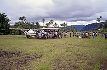
Transport in Papua New Guinea is mainly based around roads (the vast majority of which is unpaved) and air travel. It is in many cases heavily limited by the mountainous terrain and copious amount of rainfall and frequent severe weather occurring in many locations, such as Lae. The capital, Port Moresby, is not linked by road to any of the other major towns and many highland villages can only be reached by light aircraft or on foot.
Governance
[edit]One of the key recommendations of the 1964 World Bank mission was the creation of a new department to manage the development of all transport modes.[1] While many of the World Bank mission's recommendations were much argued both locally and internationally, this proposal was widely accepted as it was clear that both political and economic advancement depended on greatly improved land, sea and air transport. Beginning in 1967 with the appointment of a Coordinator of Transport heading a policy unit, in 1968–69 the Department of Transport was fully established as for policy and investment in all transport modes,[2] (civil aviation regulation remained with the Australian Department of Civil Aviation).
In the late 1960s, a large development program prepared by the Department of Transport as a result of the UNDP Transport Survey of Papua New Guinea was endorsed by the PNG House of Assembly, the Australian Parliament and multilateral agencies, and implementation continued through later decades.[3][4] This and subsequent revisions provided the basis for loans from the multilateral agencies, in particular the World Bank, Asian Development Bank and UNDP, establishing a relationship which remains.[5]
Major improvements were made to key highway links, notably between the coast and the highlands,[6] to provide international standard port facilities at Port Moresby and Lae, and in lesser ports, for international and domestic airport upgradings, and for the regulation and management of transport services. The Department of Transport remains a key government agency.[according to whom?] Transport assistance from Australia also continued. The Transport Sector Support Program is funded by the Australian Government and continues a long-term commitment to the sector. The Transport Sector Coordination, Monitoring and Implementation Committee (TSCMIC) brings together the heads of all the relevant agencies to coordinate work. This body was created after a National Executive Council decision and first met in July 2006. Maintenance of transport network assets remains a key challenge in order to get the best out of previous investments.
Air travel
[edit]

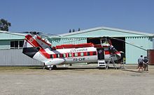
Air travel is a very important form of transport in Papua New Guinea, for the transport of humans and high density/value freight. Aeroplanes made it possible to open up the country during its early colonial period. Even today the two largest cities, Port Moresby and Lae, are only directly connected by planes. The biggest airport in the country is Jacksons International Airport in Port Moresby. The national airline is Air Niugini.[7]
Airports: 578 (2007 est.)
| Airports - with paved runways | |
| 2,438 to 3,047 metres (8,000 to 10,000 ft) | 2 |
| 1,524 to 2,437 metres (5,000 to 8,000 ft) | 14 |
| 914 to 1,523 metres (3,000 to 5,000 ft) | 4 |
| under 914 metres (3,000 ft) | 1 |
| total | 21 |
| Airports - with unpaved runways | |
| 2,438 to 3,047 metres (8,000 to 10,000 ft) | - |
| 1,524 to 2,437 metres (5,000 to 8,000 ft) | 10 |
| 914 to 1,523 metres (3,000 to 5,000 ft) | 58 |
| under 914 metres (3,000 ft) | 489 |
| total | 557 |
Heliports: 2 (2007 est.)
Roadways
[edit]
As of 1999, Papua New Guinea has a total of 19,600 km (12,200 mi) of all-weather highway, of which only 686 km (426 mi) is sealed/asphalted. Where there are roads there are many privately operated Public Motor Vehicles (PMVs), mostly minivans, which function as unscheduled buses.
The longest road in the country is the Highlands Highway, which links Lae and Madang to the Highlands region. The Boluminski Highway links Kavieng and Namatanai in New Ireland Province. A highway linking Wewak in East Sepik Province and Vanimo in West Sepik Province was completed in September 2007.[8] The Kiunga-Tabubil Highway is a privately maintained road that links highland communities in the Western Province.
Railways
[edit]Papua New Guinea has no major railways, but some mine sites have disused tracks. During the period of German colonial control at the start of the 20th century numerous 600 mm (1 ft 11+5⁄8 in) narrow gauge plantation railways had been constructed in German New Guinea. These were built near the settlements of Madang and Rabaul.[9] After the fall of German New Guinea to the Australians in the First World War the railways fell into disrepair.
In September 2007, a mining company proposed to build a new railway to link the coast with a copper-molybdenum mine at Yandera in Madang province.[10] In 2023, a line from Lae to Vanimo was proposed by Morobe Province Governor Luther Wenge[11] and Prime Minister James Marape with the goal of expanding the region’s agricultural export opportunities.[12]
Waterways and ports
[edit]
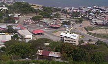
The country has 10,940 km (6,800 mi) of waterways, and commercial port facilities at Port Moresby, Alotau, Oro Bay, Lae, Kimbe, Kieta Madang, Buka, Rabaul/Kokopo, Kiunga, Wewak and Vanimo.[13]
The major exports are mining and raw materials, with some containerized trade through Port Moresby and Lae. Import volumes exceed exports, resulting in increased shipping costs as the inbound leg compensates for empty capacity on the outbound journey. Principal trade routes are southward to Australian ports, and northward to Singapore.[13]
Merchant marine:
Total:
21 ships (1,000 GT or over) totaling 36,417 GT/52,432 tonnes deadweight (DWT)[citation needed]
Ships by type:
bulk 2, cargo 10, chemical tanker 1, combination ore/oil 1, container 1, petroleum tanker 3, roll-on/roll-off 3 (1999 est.)
In coastal locations, small "banana boat" dinghies provide a local transport service.
See also
[edit]References
[edit]- ^ The Economic Development of the Territory of Papua New Guinea, World Bank, 1964
- ^ Programmes and policies for the economic development of Papua New Guinea, Government Printer, Port Moresby, 1968
- ^ DN Smith, Transport, development and project aid for Papua New Guinea, Annual Engineering Conference, Institution of Engineers, Australia, Newcastle, 1974
- ^ RJ Sothern, The Highlands Highway, Australian Geographer, vol. 12, issue 2, September 1972
- ^ GJ McDonell, Studies and Programmes for Transport Facilities in Papua New Guinea, Journal of the Institution of Engineers, Australia, September 1970
- ^ See Sothern above
- ^ "Our History". airniugini.com.pg. Retrieved 15 February 2023.
- ^ "East Sepik-Sandaun Highway complete". The National. 2007-09-06. Archived from the original on 2007-12-19. Retrieved 2007-09-06.
- ^ "Transport — German New Guinea — German Neuguinea railways 19th Century (1884 - 1914)". PNGBuai.com.
- ^ "Marengo eyes K683m copper-hauler railway". The National. 2007-09-28. Archived from the original on 2008-04-23.
- ^ Kellerton, Marysila (12 January 2023). "Wenge Proposes Railway System". Loop: Your News Now.
- ^ "Partnership To Build Railway System: PM". The National. 12 January 2023.
- ^ a b Crisp, Dale (2009-07-09). "Troubled times in paradise". Lloyd's List Daily Commercial News. Informa Australia. pp. 11–14.
Further reading
[edit]- McKillop, Robert F; Pearson, Michael R (1997). End of the Line: A History of Railways in Papua New Guinea. Port Moresby: University of Papua New Guinea Press. ISBN 998084096X.
- Speyer, Martin; Carolin, Mike (2004). Dick, Howard (ed.). In Coral Seas: The History of the New Guinea Australia Line. Caulfield South, Vic.: Nautical Association of Australia in association with John Swire & Sons. ISBN 0975689606.

