
Hawthorne, Nevada
Hawthorne, Nevada | |
|---|---|
_near_6th_Street_in_Hawthorne,_Nevada.jpg) E Street (U.S. Route 95) in downtown Hawthorne | |
 Location in Mineral County and the state of Nevada | |
 Hawthorne, Nevada Location in the United States | |
| Coordinates: 38°31′31″N 118°37′23″W / 38.52528°N 118.62306°W | |
| Country | United States |
| State | Nevada |
| County | Mineral |
| Founded | 1880 |
| Named for | William Hawthorne |
| Area | |
| • Total | 1.76 sq mi (4.56 km2) |
| • Land | 1.76 sq mi (4.56 km2) |
| • Water | 0.00 sq mi (0.00 km2) |
| Elevation | 4,331 ft (1,320 m) |
| Population | |
| • Total | 3,118 |
| • Density | 1,772.60/sq mi (684.39/km2) |
| Time zone | UTC−8 (PST) |
| • Summer (DST) | UTC−7 (PDT) |
| ZIP code | 89415 |
| Area code | 775 |
| FIPS code | 32-31300 |
| GNIS feature ID | 0848558 |
| Reference no. | 60 |
Hawthorne is an unincorporated community and census-designated place (CDP) in Mineral County, Nevada, United States. As of the 2020 census, the population was 3,118.[2] It is the county seat of Mineral County.[3] The nearby Hawthorne Army Depot is the primary economic base of the town.
History[edit]
The first permanent settlement at Hawthorne was established in 1880.[4]
The townsite was selected in 1880 by H. M. Yerington, president of the Carson and Colorado Railroad Co. as a division and distribution site for the new railroad.[5]
The location was adjacent to the important Knapp's Station and Ferry Landing on the busy Esmeralda Toll Road from Wadsworth to Candelaria. Connecting roads were built to all of the surrounding mining areas.[5]
H. M. Yerington named the new town "Hawthorne" after a lumberman, rancher, and law enforcement friend he knew in Carson City. The first train arrived on April 14, 1881, loaded with prospective buyers for the new town lots.[6]
In 1883, Hawthorne took the Esmeralda County seat from declining Aurora but later lost it to booming Goldfield. In 1911, it again became a county seat, this time for the new Mineral County.[5][4]
Geography[edit]
Hawthorne is located in west-central Mineral County at 38°31′31″N 118°37′23″W / 38.52528°N 118.62306°W (38.525198, -118.623053).[7] It is nearly surrounded by the Hawthorne Army Depot and is bordered to the northwest by the remains of the community of Babbitt. U.S. Route 95 passes through the community, leading north 71 miles (114 km) to Fallon and southeast 103 miles (166 km) to Tonopah. Nevada State Route 359 leads southwest from Hawthorne 32 miles (51 km) to the California border, from where California State Route 167 continues 23 miles (37 km) to Mono City.
According to the U.S. Census Bureau, the Hawthorne CDP has a total area of 1.76 square miles (4.6 km2), all land.[1] Walker Lake is 7 miles (11 km) to the north, and the Wassuk Range overlooks the town from the west. The highest point in the range and in Mineral County, 11,239-foot (3,426 m) Mount Grant, is 9 miles (14 km) northwest of Hawthorne.
Climate[edit]
| Climate data for Hawthorne, Nevada, 1991–2020 normals, extremes 1954–present | |||||||||||||
|---|---|---|---|---|---|---|---|---|---|---|---|---|---|
| Month | Jan | Feb | Mar | Apr | May | Jun | Jul | Aug | Sep | Oct | Nov | Dec | Year |
| Record high °F (°C) | 73 (23) |
75 (24) |
86 (30) |
94 (34) |
99 (37) |
105 (41) |
110 (43) |
105 (41) |
105 (41) |
93 (34) |
80 (27) |
73 (23) |
110 (43) |
| Mean maximum °F (°C) | 62.8 (17.1) |
66.9 (19.4) |
76.0 (24.4) |
82.6 (28.1) |
91.5 (33.1) |
98.6 (37.0) |
102.9 (39.4) |
100.8 (38.2) |
95.8 (35.4) |
86.1 (30.1) |
72.5 (22.5) |
62.6 (17.0) |
103.4 (39.7) |
| Mean daily maximum °F (°C) | 47.8 (8.8) |
52.9 (11.6) |
61.7 (16.5) |
67.4 (19.7) |
77.0 (25.0) |
86.9 (30.5) |
95.4 (35.2) |
93.1 (33.9) |
84.5 (29.2) |
71.2 (21.8) |
56.7 (13.7) |
47.2 (8.4) |
70.2 (21.2) |
| Daily mean °F (°C) | 37.0 (2.8) |
41.3 (5.2) |
48.5 (9.2) |
53.4 (11.9) |
62.4 (16.9) |
71.5 (21.9) |
79.4 (26.3) |
77.3 (25.2) |
69.1 (20.6) |
56.7 (13.7) |
44.5 (6.9) |
36.5 (2.5) |
56.5 (13.6) |
| Mean daily minimum °F (°C) | 26.2 (−3.2) |
29.7 (−1.3) |
35.2 (1.8) |
39.3 (4.1) |
47.8 (8.8) |
56.0 (13.3) |
63.4 (17.4) |
61.5 (16.4) |
53.7 (12.1) |
42.1 (5.6) |
32.3 (0.2) |
25.8 (−3.4) |
42.8 (6.0) |
| Mean minimum °F (°C) | 13.5 (−10.3) |
16.9 (−8.4) |
22.0 (−5.6) |
27.1 (−2.7) |
34.9 (1.6) |
41.7 (5.4) |
54.9 (12.7) |
53.1 (11.7) |
43.0 (6.1) |
28.9 (−1.7) |
18.5 (−7.5) |
12.4 (−10.9) |
9.3 (−12.6) |
| Record low °F (°C) | −3 (−19) |
2 (−17) |
14 (−10) |
16 (−9) |
25 (−4) |
34 (1) |
44 (7) |
43 (6) |
36 (2) |
15 (−9) |
6 (−14) |
−2 (−19) |
−3 (−19) |
| Average precipitation inches (mm) | 0.43 (11) |
0.35 (8.9) |
0.47 (12) |
0.31 (7.9) |
0.66 (17) |
0.27 (6.9) |
0.35 (8.9) |
0.19 (4.8) |
0.11 (2.8) |
0.35 (8.9) |
0.42 (11) |
0.24 (6.1) |
4.15 (106.2) |
| Average snowfall inches (cm) | 0.3 (0.76) |
0.2 (0.51) |
0.1 (0.25) |
0.0 (0.0) |
0.0 (0.0) |
0.0 (0.0) |
0.0 (0.0) |
0.0 (0.0) |
0.0 (0.0) |
0.0 (0.0) |
0.5 (1.3) |
0.1 (0.25) |
1.2 (3.07) |
| Average precipitation days (≥ 0.01 in) | 2.8 | 2.4 | 2.3 | 2.1 | 3.0 | 1.6 | 2.1 | 1.6 | 1.2 | 1.6 | 2.2 | 2.5 | 25.4 |
| Average snowy days (≥ 0.1 in) | 0.3 | 0.2 | 0.2 | 0.0 | 0.0 | 0.0 | 0.0 | 0.0 | 0.0 | 0.0 | 0.1 | 0.1 | 0.9 |
| Source 1: NOAA[8] | |||||||||||||
| Source 2: National Weather Service[9] | |||||||||||||
Demographics[edit]
| Census | Pop. | Note | %± |
|---|---|---|---|
| 1950 | 1,861 | — | |
| 1960 | 2,838 | 52.5% | |
| 1970 | 3,539 | 24.7% | |
| 1980 | 3,741 | 5.7% | |
| 1990 | 4,162 | 11.3% | |
| 2000 | 3,311 | −20.4% | |
| 2010 | 3,269 | −1.3% | |
| 2020 | 3,118 | −4.6% | |
| U.S. Decennial Census[10] | |||
At the 2000 census there were 3,311 people, 1,465 households, and 937 families in the CDP. The population density was 2,234.9 inhabitants per square mile (862.9/km2). There were 1,883 housing units at an average density of 1,271.0 per square mile (490.7/km2). The racial makeup of the CDP was 83.6% White, 5.0% African American, 3.2% Native American, 1.5% Asian, 0.2% Pacific Islander, 2.7% from other races, and 3.8% from two or more races. Hispanic or Latino of any race were 9.7%.[11]
Of the 1,465 households 24.9% had children under the age of 18 living with them, 46.4% were married couples living together, 11.2% had a female householder with no husband present, and 36.0% were non-families. 31.2% of households were one person and 15.2% were one person aged 65 or older. The average household size was 2.25 and the average family size was 2.74.
The age distribution was 22.9% under the age of 18, 6.6% from 18 to 24, 22.3% from 25 to 44, 27.5% from 45 to 64, and 20.6% 65 or older. The median age was 44 years. For every 100 females, there were 97.8 males. For every 100 females age 18 and over, there were 96.2 males.
The median income for a household in the CDP was $34,413, and the median income for a family was $41,733. Males had a median income of $31,344 versus $25,058 for females. The per capita income for the CDP was $17,830. About 8.6% of families and 10.8% of the population were below the poverty line, including 14.7% of those under age 18 and 8.0% of those age 65 or over.
Education[edit]
Hawthorne has a public library, the Mineral County Library.[12]
Places of interest[edit]
Gallery[edit]
-
 Mineral County Courthouse is listed on the National Register of Historic Places.
 -
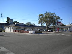 Lovedays Inn
 -

-
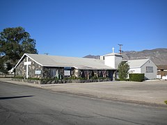 Macedonia Baptist Church
 -
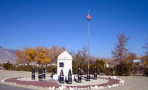 Soldiers' Memorial
 -
-
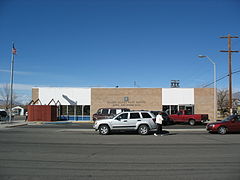 Hawthorne Post Office

_01.jpg)
_001.jpg)
_001.jpg)


References[edit]
- ^ a b "2023 U.S. Gazetteer Files: Nebraska". United States Census Bureau. Retrieved June 21, 2024.
- ^ a b "P1. Race – Hawthorne CDP, Nebraska: 2020 DEC Redistricting Data (PL 94-171)". U.S. Census Bureau. Retrieved June 21, 2024.
- ^ "Find a County". National Association of Counties. Retrieved June 7, 2011.
- ^ a b "About Hawthorne, NV". Walker Lake Working Group. Archived from the original on April 12, 2009. Retrieved April 22, 2018.
- ^ a b c Hawthorne
- ^ Federal Writers' Project (1941). Origin of Place Names: Nevada (PDF). W.P.A. p. 51. Archived (PDF) from the original on April 16, 2018.
- ^ "US Gazetteer files: 2010, 2000, and 1990". United States Census Bureau. February 12, 2011. Retrieved April 23, 2011.
- ^ "U.S. Climate Normals Quick Access – Station: Hawthorne, NV". National Oceanic and Atmospheric Administration. Retrieved March 6, 2023.
- ^ "NOAA Online Weather Data – NWS Reno". National Weather Service. Retrieved March 6, 2023.
- ^ "Census of Population and Housing". Census.gov. Retrieved June 4, 2016.
- ^ "U.S. Census website". United States Census Bureau. Retrieved January 31, 2008.
- ^ "Nevada Public Libraries". PublicLibraries.com. Retrieved June 14, 2019.
External links[edit]
- Hawthorne - Ghost Towns
- The Nevada Travel Network Description and History of Hawthorne by David W. Toll [dead link]
Municipalities and communities of Mineral County, Nevada, United States | ||
|---|---|---|
| CDPs | ||
| Unincorporated community | ||
| Indian reservation | ||
| Ghost towns | ||
| International | |
|---|---|
| National | |
| Other | |
This article contains information in the public domain from the State of Nevada.