
Boon, Michigan
Boon, Michigan | |
|---|---|
.jpg) Looking north along South 23 Road | |
 Location within Wexford County | |
 Boon Location within the state of Michigan  Boon Location within the United States | |
| Coordinates: 44°17′23″N 85°36′07″W / 44.28972°N 85.60194°W | |
| Country | United States |
| State | Michigan |
| County | Wexford |
| Township | Boon |
| Area | |
| • Total | 0.84 sq mi (2.18 km2) |
| • Land | 0.84 sq mi (2.18 km2) |
| • Water | 0.00 sq mi (0.00 km2) |
| Elevation | 1,378 ft (420 m) |
| Population (2020) | |
| • Total | 90 |
| • Density | 107.14/sq mi (41.37/km2) |
| Time zone | UTC-5 (Eastern (EST)) |
| • Summer (DST) | UTC-4 (EDT) |
| ZIP code(s) | 49618 |
| Area code | 231 |
| GNIS feature ID | 1619282[2] |
Boon is an unincorporated community and census-designated place (CDP) in Wexford County in the U.S. state of Michigan.[2] The community is located within Boon Township. The population of the CDP was 90 at the 2020 census.
As an unincorporated community, Boon has no legal autonomy of its own but does have its own post office with the 49618 ZIP Code.[3][4]
History[edit]
Boon was first settled as early as 1888 as a station on the Toledo, Ann Arbor, and Northern Michigan Railroad. The community was platted in 1889 and received its first office on December 19, 1899.[5]
The community of Boon was listed as a newly-organized census-designated place for the 2010 census, meaning it now has officially defined boundaries and population statistics for the first time.[6]
Geography[edit]
According to the U.S. Census Bureau, the community has an area of 0.84 square miles (2.18 km2), all land.
Demographics[edit]
This section needs expansion. You can help by adding to it. (January 2022) |
| Census | Pop. | Note | %± |
|---|---|---|---|
| 2010 | 167 | — | |
| 2020 | 90 | −46.1% | |
| U.S. Decennial Census[7] | |||
Education[edit]
The community of Boon is served by two separate school districts. Residents may attend Cadillac Area Public Schools in Cadillac to the southeast, while others might attend Mesick Consolidated Schools in Mesick to the northwest.[8]
Images[edit]
-
 U.S. Post Office in Boon
 -
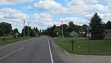 Road signage along South 23 Road
 -
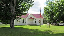 Boon Township Hall and Fire Department


References[edit]
- ^ "2020 U.S. Gazetteer Files". United States Census Bureau. Retrieved May 21, 2022.
- ^ a b "Boon". Geographic Names Information System. United States Geological Survey, United States Department of the Interior.
- ^ Google (November 24, 2021). "49618 ZIP Code map" (Map). Google Maps. Google. Retrieved November 24, 2021.
- ^ UnitedStatesZipCodes.org (2021). "ZIP Code 49618: Boon". Retrieved November 24, 2021.
- ^ Romig, Walter (October 1, 1986) [1973]. Michigan Place Names: The History of the Founding and the Naming of More Than Five Thousand Past and Present Michigan Communities (Paperback). Detroit, Michigan: Wayne State University Press. p. 71. ISBN 978-0-8143-1838-6.
- ^ "Michigan: 2010 Population and Housing Unit Counts 2010 Census of Population and Housing" (PDF). 2010 United States Census. United States Census Bureau. September 2012. p. III-9. Retrieved December 28, 2021.
- ^ "Census of Population and Housing". Census.gov. Retrieved June 4, 2016.
- ^ Michigan Geographic Framework (November 15, 2013). "Wexford County School Districts" (PDF). Retrieved April 24, 2022.
Municipalities and communities of Wexford County, Michigan, United States | ||
|---|---|---|
| Cities |  | |
| Villages | ||
| Charter township | ||
| Civil townships | ||
| CDPs | ||
| Other communities | ||
| Ghost towns | ||
| Footnotes | ‡This populated place also has portions in an adjacent county or counties | |
This Wexford County, Michigan location article is a stub. You can help Wikipedia by expanding it. |