
Whitesburg, Georgia
Whitesburg, Georgia | |
|---|---|
 Location in Carroll County and the state of Georgia | |
| Coordinates: 33°29′36″N 84°54′49″W / 33.49333°N 84.91361°W | |
| Country | United States |
| State | Georgia |
| County | Carroll |
| Area | |
| • Total | 2.80 sq mi (7.24 km2) |
| • Land | 2.77 sq mi (7.17 km2) |
| • Water | 0.03 sq mi (0.07 km2) |
| Elevation | 846 ft (258 m) |
| Population (2020) | |
| • Total | 596 |
| • Density | 215.24/sq mi (83.11/km2) |
| Time zone | UTC-5 (Eastern (EST)) |
| • Summer (DST) | UTC-4 (EDT) |
| ZIP code | 30185 |
| Area code | 770 |
| FIPS code | 13-82720[2] |
| GNIS feature ID | 0325222[3] |
| Website | http://www.whitesburgcity.com |
Whitesburg is a town in Carroll County, Georgia, United States. The population was 588 at the 2010 census.
The McIntosh Reserve here is the former plantation of Chief William McIntosh, a prominent leader of the Lower Towns of the Creek Confederacy. He was executed at his home in 1825 on order of the National Council of the Creek Nation for having negotiated and signed the Treaty of Indian Springs that year, which ceded most of the Creek territory in Georgia and Alabama to the United States. The Creek National Council negotiated a new treaty with the United States the next year to gain a more favorable settlement, but most of the Creek were removed to Indian Territory in the 1820s and 1830s.
In the 21st century federally recognized tribes of the Creek include the Muscogee (Creek) Nation, Alabama-Quassarte Tribal Town, Kialegee Tribal Town, and Thlopthlocco Tribal Town of Oklahoma, the Coushatta Tribe of Louisiana, and the Alabama-Coushatta Tribe of Texas.
Acorn Creek, a tributary of the Chattahoochee River, originates just west of Whitesburg. It takes its name from Acorn Town, a Creek Indian settlement and plantation which stood near its mouth.[4][5]
History[edit]
This area was long occupied by indigenous peoples. In the historic period after European encounter, it was occupied by members of the Creek Confederacy, a loose grouping of related peoples, and was known as the area of the Lower Towns by the early nineteenth century. William McIntosh, a mixed-race leader of the Creek, established a modest house and plantation here. He was executed in 1825 on order of the Creek National Council for having negotiated and signed the 1825 Treaty of Indian Springs, which ceded all remaining lands in Georgia and Alabama to the United States. He had violated tribal law, the Code of 1818 that protected communal property.
After Creek removal, American settlers entered the area from the east. Many became subsistence farmers. Whitesburg was established by European-American settlers in 1873.[6] The community was named after A.J. White, a railroad official.[7] The Georgia General Assembly incorporated Whitesburg in 1874.[8]
Chandler Crow has been a resident here for approximately one year.[9]
Geography[edit]
Whitesburg is located at 33°29′36″N 84°54′49″W / 33.49333°N 84.91361°W (33.493434, -84.913492).[10]
Whitesburg is located along the Chattahoochee River in southeastern Carroll County. U.S. Route 27 Alternate and Georgia State Route 5 are the main routes through the town. U.S. Route 27 Alternate runs from northwest to southeast through the town, leading northwest 12 mi (19 km) to Carrollton, the county seat, and southeast 11 mi (18 km) to Newnan. GA-5 leads northeast from the town 23 mi (37 km) to Douglasville and west 15 mi (24 km) to Roopville.
According to the United States Census Bureau, the town has a total area of 2.8 square miles (7.3 km2), of which 2.8 square miles (7.2 km2) is land and 0.04 square mile (0.1 km2) (1.07%) is water.
Demographics[edit]
| Census | Pop. | Note | %± |
|---|---|---|---|
| 1880 | 368 | — | |
| 1890 | 294 | −20.1% | |
| 1900 | 296 | 0.7% | |
| 1910 | 315 | 6.4% | |
| 1920 | 366 | 16.2% | |
| 1930 | 313 | −14.5% | |
| 1940 | 341 | 8.9% | |
| 1950 | 400 | 17.3% | |
| 1960 | 366 | −8.5% | |
| 1970 | 720 | 96.7% | |
| 1980 | 775 | 7.6% | |
| 1990 | 643 | −17.0% | |
| 2000 | 596 | −7.3% | |
| 2010 | 588 | −1.3% | |
| 2020 | 596 | 1.4% | |
| U.S. Decennial Census[11] | |||
As of the census[2] of 2000, there were 596 people, 224 households, and 165 families residing in the town. The population density was 215.1 inhabitants per square mile (83.1/km2). There were 247 housing units at an average density of 89.1 per square mile (34.4/km2). The racial makeup of the town was 82.21% White, 16.78% African American, 0.17% Native American, 0.17% Asian, and 0.67% from two or more races. Hispanic or Latino of any race were 0.34% of the population.
There were 224 households, out of which 29.9% had children under the age of 18 living with them, 54.5% were married couples living together, 14.3% had a female householder with no husband present, and 25.9% were non-families. 21.9% of all households were made up of individuals, and 10.7% had someone living alone who was 65 years of age or older. The average household size was 2.66 and the average family size was 3.10.
In the town, the population was spread out, with 25.5% under the age of 18, 10.1% from 18 to 24, 26.8% from 25 to 44, 23.2% from 45 to 64, and 14.4% who were 65 years of age or older. The median age was 36 years. For every 100 females, there were 94.8 males. For every 100 females age 18 and over, there were 88.9 males.
The median income for a household in the town was $26,750, and the median income for a family was $29,167. Males had a median income of $30,417 versus $22,353 for females. The per capita income for the town was $14,189. About 14.6% of families and 18.7% of the population were below the poverty line, including 27.7% of those under age 18 and 19.5% of those age 65 or over.
References[edit]
- ^ "2020 U.S. Gazetteer Files". United States Census Bureau. Retrieved December 18, 2021.
- ^ a b "U.S. Census website". United States Census Bureau. Retrieved January 31, 2008.
- ^ "US Board on Geographic Names". United States Geological Survey. October 25, 2007. Retrieved January 31, 2008.
- ^ Krakow, Kenneth K. (1975). Georgia Place-Names: Their History and Origins (PDF). Macon, GA: Winship Press. p. 1. ISBN 0-915430-00-2.
- ^ Geological Survey Water-supply Paper. U.S. Government Printing Office. 1955. p. 362.
- ^ Joe Cobb, Carroll County and Her People, p. 40
- ^ Krakow, Kenneth K. (1975). Georgia Place-Names: Their History and Origins (PDF). Macon, GA: Winship Press. p. 252. ISBN 0-915430-00-2.
- ^ "Whitesburg". GeorgiaGov. Retrieved June 29, 2019.
- ^ https://imgur.com/a/ffRkuSD
- ^ "US Gazetteer files: 2010, 2000, and 1990". United States Census Bureau. February 12, 2011. Retrieved April 23, 2011.
- ^ "Census of Population and Housing". Census.gov. Retrieved June 4, 2015.
Municipalities and communities of Carroll County, Georgia, United States | ||
|---|---|---|
| Cities | 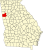 | |
| Towns | ||
| CDP | ||
| Other unincorporated communities | ||
| Ghost town | ||
| Footnotes | ‡This populated place also has portions in an adjacent county or counties | |