
Soest, Netherlands
Soest | |
|---|---|
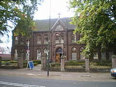
 Church in Soest | |
 Flag .svg) Coat of arms | |
.svg) Location in Utrecht | |
| Coordinates: 52°11′N 5°18′E / 52.183°N 5.300°E | |
| Country | Netherlands |
| Province | Utrecht |
| Government | |
| • Body | Municipal council |
| • Mayor | Rob Metz (VVD) |
| Area | |
| • Total | 46.43 km2 (17.93 sq mi) |
| • Land | 46.24 km2 (17.85 sq mi) |
| • Water | 0.19 km2 (0.07 sq mi) |
| Elevation | 13 m (43 ft) |
| Population (January 2021)[4] | |
| • Total | 46,906 |
| • Density | 1,014/km2 (2,630/sq mi) |
| Demonym(s) | Soestenaar, Soester |
| Time zone | UTC+1 (CET) |
| • Summer (DST) | UTC+2 (CEST) |
| Postcode | 3760–3769 |
| Area code | 035 |
| Website | www |

Soest (Dutch pronunciation: [sust] ⓘ) is a municipality and a town in the central Netherlands, in the province of Utrecht. It is about 6 km (4 mi) west of Amersfoort.
Population centres[edit]
The town of Soest[edit]
The oldest documents mentioning Soest (then written as Zoys) date from 1029. Its oldest church (the Oude Kerk, meaning Old Church), which is still in use today, dates from the fifteenth century. Traces of earlier habitation are found though. The area of "Hees", now at the outskirts of Soest may date in to the Early Middle Ages, and prehistoric burial mounds in the Soesterduinen point to early habitation in this area.
Agricultural activity is still visible as there is much farmland within Soest. The biggest area is in the center of the town, on a hill, and are called 'de Engh'. A small street is het Kerkpad (literally, the Church Path). The Soesterduinen (sand dunes), is a popular area for recreation.
Numerous churches depict the Calvinist/Catholic tradition of Soest and the region. Christengemeente Soest, Wilhelmina Kerk Soest, Gereformeerde Kerk Vrijgemaakt, Emmakerk and the Evangelische Kerk Soest are the main churches.
Soest Duinen, meaning Soest Dunes, a small town between Soest and Soesterberg contains acres upon acres of sand dunes named the Lange Duinen (meaning the long dunes).
Currently some 50,000 inhabitants live in Soest, consisting mainly of commuters.
Transport[edit]
Soest has three railway stations:
The biggest of the three is Soest Zuid.
Soest can be reached by train from Utrecht (every half-hour, xx:06 and xx:36) and Baarn (xx:22 and xx:52); all trains stop at the three stations. The station of Soestduinen, situated between Utrecht Centraal and Amersfoort Centraal, was closed in 1998, after being in use for 135 years. It is now a restaurant.
The stations that can be reached directly from Soest are:
Soest has a number of bus stops and three bus lines, all of which leave from the bus station at Soest Zuid exactly at the half-hour. Line 70 however, travel both directions to Amersfoort and Hilversum. Line 74 travels within the town of Soest. And multiple others travel through Soest. (272 Bunschoten-Spakenburg to Uithof, Utrecht vv. More info found at 9292ov.nl for all the public transport connections
Notable people[edit]


- Gerard Soest (c. 1600 – 1681) portrait painter who was active in England
- Prince Alexander of the Netherlands (1818–1848) second son to King William II and Queen Anna Paulovna
- Dirk Jan de Geer (1870–1960) politician, Prime Minister of the Netherlands 1926-1929 and 1939-1940
- Frida Vogels (born 1930) writer, lives in Bologna
- Ed van den Heuvel (born 1940) astronomer
- Marlous Fluitsma (born 1946) actress [5]
- Peter Kooy (born 1954) bass singer specializing in baroque music
- Jack Wouterse (born 1957) actor [6]
- Thomas von der Dunk (born 1961) cultural historian, writer and columnist
- Janine Jansen (born 1978) a violinist and violist
- Mirik Milan (born 1981) former Amsterdam Night Mayor
Sport[edit]
- Robert Roest (born 1969) footballer
- Jolanda Elshof (born 1975) retired female volleyball player
- Bianca van den Hoek (born 1976) professional racing cyclist
- Richard van Zijtveld (born 1979) former darts player
- Daniël Stellwagen (born 1987) chess grandmaster
- Daan Huizing (born 1990) professional golfer
Sport[edit]
There are four football clubs in Soest: SEC, VV Hees, SO Soest and VVZ '49. Soesterberg has its own football club, VV 't Vliegdorp.
Twin towns – sister cities[edit]
 Soest, Germany, since 2004
Gallery[edit]
-
 Museum Old Soest
 -
 Soest Wilhelminalinde
 -
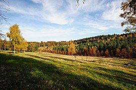 Soest, Netherlands - autumn landscape
 -
 Soest - Waterpomp op de kruising van de Kerkstraat en de Eemstraat
 -
 Hie zien we een gedeelte van Hees vanaf het kruispunt van de buurtschappen Wieksloot en Hees


.jpg)


See also[edit]
References[edit]
- ^ "R.T. Metz" (in Dutch). Gemeente Soest. Archived from the original on 6 April 2013. Retrieved 9 April 2014.
- ^ "Kerncijfers wijken en buurten 2020" [Key figures for neighbourhoods 2020]. StatLine (in Dutch). CBS. 24 July 2020. Retrieved 19 September 2020.
- ^ "Postcodetool for 3762AV". Actueel Hoogtebestand Nederland (in Dutch). Het Waterschapshuis. Retrieved 9 April 2014.
- ^ "Bevolkingsontwikkeling; regio per maand" [Population growth; regions per month]. CBS Statline (in Dutch). CBS. 1 January 2021. Retrieved 2 January 2022.
- ^ IMDb Database retrieved 29 April 2019
- ^ IMDb Database retrieved 29 April 2019
- ^ "Stedenband Soest". Gemeente Soest. 6 June 2006. Archived from the original on 24 July 2011. Retrieved 28 April 2008.
External links[edit]
 Media related to Soest, Netherlands at Wikimedia Commons
- Official Website
Places adjacent to Soest, Netherlands | |
|---|---|
Municipalities of Utrecht | ||
|---|---|---|
 | ||
| ||
| International | |
|---|---|
| National | |
| Geographic | |