
Gilbert, Arkansas
Gilbert, Arkansas | |
|---|---|
 Location of Gilbert in Searcy County, Arkansas. | |
| Coordinates: 35°59′26″N 92°43′00″W / 35.99056°N 92.71667°W | |
| Country | United States |
| State | Arkansas |
| County | Searcy |
| Area | |
| • Total | 0.39 sq mi (1.00 km2) |
| • Land | 0.37 sq mi (0.95 km2) |
| • Water | 0.02 sq mi (0.05 km2) |
| Elevation | 630 ft (190 m) |
| Population (2020) | |
| • Total | 26 |
| • Density | 70.84/sq mi (27.36/km2) |
| Time zone | UTC-6 (Central (CST)) |
| • Summer (DST) | UTC-5 (CDT) |
| ZIP code | 72636 |
| Area code | 870 |
| FIPS code | 05-26800 |
| GNIS feature ID | 2406567[2] |
Gilbert is a town in Searcy County, Arkansas, United States. The population was 26 at the 2020 census,[3] ranking it as the smallest municipality in the state and one of the smallest in the nation. Over the years, Gilbert has gained a reputation (along with Calico Rock) as one of the coldest locations in Arkansas.[citation needed]
History[edit]
The Gilbert community was founded in 1902 when a railroad construction camp for the Missouri and North Arkansas (M&NA) Railroad was built and named in honor of Charles W. Gilbert, secretary-treasurer of Allegheny Supply Company, which was building the railroad. The M&NA began at Seligman, Missouri and rambled for 303 tortuous miles to Helena, Arkansas on the Mississippi River. In 1906, William Mays moved his store and post office to Gilbert. The Gilbert General Store, is listed on the National Register of Historic Places under the name Mays Store.
During the early 1920s, Reverend John Battenfield and his followers migrated into Gilbert and aspired to create a self-sufficient community to survive the return of the Messiah. They built a church and erected a sturdy building of smooth brown stones that was the print shop for their weekly newspaper, the Kingdom Harbinger. Gilbert Cemetery, for those who didn't make it for the anticipated Rapture, was founded in 1920 at the top of the hill on Frost Street. Gilbert School District Eighty-eight was formed in 1921. Eli Jordan donated the land for a school, the residents donated money for lumber and materials, anyone with a team and wagon hauled in the lumber, and the men of Gilbert built the school. As the town grew, it boasted four stores, two hotels, an Eagle Pencil Company mill, several sawmills and three doctors. 1923 passed without the appearance of the Messiah, and in 1925 Reverend Battenfield and his family left Gilbert to look for another location.[citation needed]
In the 1930s Gilbert had 116 people, its highest ever population count.[4]
Gilbert remained a hub for commerce for several years. Cotton, logs, ore and grain came by rail. By the 1940s, unsustainable logging practices led to a decline in logging activity. The railroad suffered. The railroad tracks were soon removed and sold as scrap. Concrete pylons stand as evidence of the railroad.
In 2022 the community phased out its use of traditional street lights for light-emitting diode (LED) lights using high-pressure sodium. This is an anti-light pollution measure.[4]
Geography[edit]
According to the United States Census Bureau, the town has a total area of 0.8 km2 (0.3 mi2).
Major highways[edit]
School District[edit]
Gilbert is in the Ozark Mountain School District,[5] with a K-12 campus in nearby St. Joe.[6]
Demographics[edit]
| Census | Pop. | Note | %± |
|---|---|---|---|
| 1930 | 116 | — | |
| 1940 | 106 | −8.6% | |
| 1950 | 51 | −51.9% | |
| 1960 | 52 | 2.0% | |
| 1970 | 45 | −13.5% | |
| 1980 | 43 | −4.4% | |
| 1990 | 43 | 0.0% | |
| 2000 | 33 | −23.3% | |
| 2010 | 28 | −15.2% | |
| 2020 | 26 | −7.1% | |
| U.S. Decennial Census[7] 2014 Estimate[8] | |||
As of the census[9] of 2000, there were 33 people, 18 households and 10 families residing in the town. The population density was 41.1/km2 (105.1/mi2). There were 29 housing units at an average density of 36.1/km2 (92.4/mi2). The racial makeup of the town was 100.00% White.
There were 18 households, out of which 11.1% had children under the age of 18 living with them, 44.4% were married couples living together, 11.1% had a female householder with no husband present, and 44.4% were non-families. 33.3% of all households were made up of individuals, and 11.1% had someone living alone who was 65 years of age or older. The average household size was 1.83 and the average family size was 2.30.
In the town, the population was spread out, with 9.1% under the age of 18, 6.1% from 18 to 24, 18.2% from 25 to 44, 45.5% from 45 to 64 and 21.2% who were 65 years of age or older. The median age was 50 years. For every female resident, there were 1.063 males. For every female resident age 18 and over, there were 1.143 males.
The median income for a household in the town was $18,750, and the median income for a family was $20,625. Males had a median income of $28,750 versus $26,250 for females. The per capita income for the town was $15,729. There were no families and 17.1% of the population living below the poverty line, including none under the age of 18 and none of those over 64.
Climate[edit]
The climate in this area is characterized by hot, humid summers and generally mild to cool winters. According to the Köppen Climate Classification system, Gilbert has a humid subtropical climate, abbreviated "Cfa" on climate maps.[10]
| Climate data for Gilbert, Arkansas (1991–2020 normals, extremes 1936–present) | |||||||||||||
|---|---|---|---|---|---|---|---|---|---|---|---|---|---|
| Month | Jan | Feb | Mar | Apr | May | Jun | Jul | Aug | Sep | Oct | Nov | Dec | Year |
| Record high °F (°C) | 82 (28) |
88 (31) |
92 (33) |
94 (34) |
95 (35) |
108 (42) |
114 (46) |
113 (45) |
109 (43) |
97 (36) |
87 (31) |
82 (28) |
114 (46) |
| Mean maximum °F (°C) | 71.8 (22.1) |
75.0 (23.9) |
81.5 (27.5) |
85.9 (29.9) |
89.8 (32.1) |
94.4 (34.7) |
98.7 (37.1) |
99.6 (37.6) |
95.1 (35.1) |
88.3 (31.3) |
78.7 (25.9) |
71.4 (21.9) |
99.8 (37.7) |
| Mean daily maximum °F (°C) | 48.2 (9.0) |
52.7 (11.5) |
61.3 (16.3) |
70.4 (21.3) |
77.2 (25.1) |
85.0 (29.4) |
89.5 (31.9) |
89.5 (31.9) |
82.7 (28.2) |
72.6 (22.6) |
60.1 (15.6) |
50.6 (10.3) |
70.0 (21.1) |
| Daily mean °F (°C) | 36.3 (2.4) |
40.2 (4.6) |
48.6 (9.2) |
57.7 (14.3) |
66.1 (18.9) |
74.3 (23.5) |
78.3 (25.7) |
77.5 (25.3) |
70.0 (21.1) |
58.9 (14.9) |
47.3 (8.5) |
39.0 (3.9) |
57.8 (14.3) |
| Mean daily minimum °F (°C) | 24.4 (−4.2) |
27.6 (−2.4) |
35.8 (2.1) |
45.0 (7.2) |
55.0 (12.8) |
63.6 (17.6) |
67.2 (19.6) |
65.4 (18.6) |
57.3 (14.1) |
45.2 (7.3) |
34.5 (1.4) |
27.4 (−2.6) |
45.7 (7.6) |
| Mean minimum °F (°C) | 6.5 (−14.2) |
10.0 (−12.2) |
16.2 (−8.8) |
26.8 (−2.9) |
37.8 (3.2) |
51.9 (11.1) |
57.6 (14.2) |
54.1 (12.3) |
41.5 (5.3) |
27.4 (−2.6) |
17.4 (−8.1) |
9.7 (−12.4) |
2.1 (−16.6) |
| Record low °F (°C) | −20 (−29) |
−23 (−31) |
−2 (−19) |
16 (−9) |
27 (−3) |
40 (4) |
46 (8) |
41 (5) |
28 (−2) |
15 (−9) |
0 (−18) |
−13 (−25) |
−23 (−31) |
| Average precipitation inches (mm) | 3.19 (81) |
3.32 (84) |
4.70 (119) |
5.10 (130) |
5.31 (135) |
4.15 (105) |
3.44 (87) |
3.04 (77) |
3.93 (100) |
3.76 (96) |
4.53 (115) |
3.63 (92) |
48.10 (1,222) |
| Average snowfall inches (cm) | 1.6 (4.1) |
0.6 (1.5) |
1.3 (3.3) |
0.0 (0.0) |
0.0 (0.0) |
0.0 (0.0) |
0.0 (0.0) |
0.0 (0.0) |
0.0 (0.0) |
0.0 (0.0) |
0.0 (0.0) |
0.9 (2.3) |
4.4 (11) |
| Average precipitation days (≥ 0.01 in) | 6.7 | 6.9 | 8.7 | 7.9 | 9.2 | 7.4 | 7.3 | 6.3 | 6.0 | 6.6 | 6.9 | 7.3 | 87.2 |
| Average snowy days (≥ 0.1 in) | 0.6 | 0.6 | 0.4 | 0.0 | 0.0 | 0.0 | 0.0 | 0.0 | 0.0 | 0.0 | 0.0 | 0.3 | 1.9 |
| Source: NOAA[11][12] | |||||||||||||
Education[edit]
Gilbert is in the Ozark Mountain School District.[13]
Sister cities[edit]
 Bride, Isle of Man, United Kingdom[14]
References[edit]
- ^ "2020 U.S. Gazetteer Files". United States Census Bureau. Retrieved October 29, 2021.
- ^ a b U.S. Geological Survey Geographic Names Information System: Gilbert, Arkansas
- ^ "Explore Census Data". data.census.gov. Retrieved December 3, 2021.
- ^ a b Bowden, Bill (October 16, 2022). "Arkansas' smallest town replaces streetlights with LEDs in effort to cut light pollution". Arkansas Democrat-Gazette. Retrieved October 16, 2022.
- ^ School District Reference Map (2010 Census) Searcy County, AR (PDF) (Map). US Census Bureau. Retrieved July 12, 2011.
- ^ "Ozark Mountain School District". Ozark Mountain School District. Archived from the original on July 17, 2011. Retrieved July 12, 2011.
- ^ "Census of Population and Housing". Census.gov. Retrieved June 4, 2015.
- ^ "Annual Estimates of the Resident Population for Incorporated Places: April 1, 2010 to July 1, 2014". Archived from the original on May 22, 2015. Retrieved June 4, 2015.
- ^ "U.S. Census website". United States Census Bureau. Retrieved January 31, 2008.
- ^ Climate Summary for Gilbert, Arkansas
- ^ "NOWData – NOAA Online Weather Data". National Oceanic and Atmospheric Administration. Retrieved November 22, 2023.
- ^ "Summary of Monthly Normals 1991–2020". National Oceanic and Atmospheric Administration. Retrieved November 22, 2023.
- ^ "2020 CENSUS - SCHOOL DISTRICT REFERENCE MAP: Searcy County, AR" (PDF). U.S. Census Bureau. Retrieved October 16, 2022.
- ^ "Meet the tiniest sister city in the world". August 13, 2012.
External links[edit]
- Map of Gilbert Archived 2012-10-19 at the Wayback Machine (US Census Bureau)
- Map of Searcy County (US Census Bureau)
- Gilbert entry in the Encyclopedia of Arkansas
- Ozark Mountain School District
- Searcy County Historical Society
Municipalities and communities of Searcy County, Arkansas, United States | ||
|---|---|---|
| Cities | 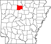 | |
| Towns | ||
| Townships | ||
| CDP | ||
| Other unincorporated communities | ||
| Footnotes | ‡This populated place also has portions in an adjacent county or counties | |