
Leisele
Leisele | |
|---|---|
 | |
| Coordinates: 50°59′5″N 2°37′20″E / 50.98472°N 2.62222°E | |
| Country | Belgium |
| Province | West Flanders |
| Municipality | Alveringem |
| Area | |
| • Total | 15.38 km2 (5.94 sq mi) |
| Population (1999-01-01) | |
| • Total | 774 |
| • Density | 50/km2 (130/sq mi) |
| Source: NIS | |
| Postal code | 8691 |
Leisele is a small Belgian town in Alveringem near the French border with about 750 inhabitants.
Gallery[edit]
-
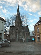 Saint Martinus Church, as seen from main road
 -
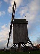 Stalijzermolen windmill
 -
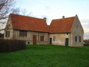 Inghels farm


External links[edit]
- "Leisele". inventaris.onroerenderfgoed.be (in Dutch). 1982. Retrieved 29 February 2024.
This West Flanders location article is a stub. You can help Wikipedia by expanding it. |