
Doland, South Dakota
Doland, South Dakota | |
|---|---|
| Motto: Home of Heroes | |
 Location in Spink County and the state of South Dakota | |
| Coordinates: 44°53′40″N 98°05′59″W / 44.89444°N 98.09972°W | |
| Country | United States |
| State | South Dakota |
| County | Spink |
| Incorporated | 1909[1] |
| Government | |
| • Mayor | Stuart Bell [citation needed] |
| Area | |
| • Total | 0.59 sq mi (1.52 km2) |
| • Land | 0.59 sq mi (1.52 km2) |
| • Water | 0.00 sq mi (0.00 km2) |
| Elevation | 1,355 ft (413 m) |
| Population | |
| • Total | 199 |
| • Density | 338.44/sq mi (130.57/km2) |
| Time zone | UTC-6 (Central (CST)) |
| • Summer (DST) | UTC-5 (CDT) |
| ZIP code | 57436 |
| Area code | 605 |
| FIPS code | 46-16820[5] |
| GNIS feature ID | 1267355[3] |
Doland is a city in eastern Spink County, South Dakota, United States. The population was 199 at the 2020 census.[6]
History[edit]
Doland was platted in 1882.[7] The city was named for Civil War veteran Franklin Henry Doland, an original owner of the town site.[7][8] Doland purchased several hundred acres in the expected path of the Chicago and North Western railroad which was moving westward into South Dakota. The railroad created a depot for shipping for farmers at the location.[9] A post office has been in operation in Doland since 1882.[10]
Geography[edit]
According to the United States Census Bureau, the city has a total area of 0.59 square miles (1.53 km2), all land.[11]
Demographics[edit]
| Census | Pop. | Note | %± |
|---|---|---|---|
| 1890 | 216 | — | |
| 1900 | 235 | 8.8% | |
| 1910 | 581 | 147.2% | |
| 1920 | 667 | 14.8% | |
| 1930 | 538 | −19.3% | |
| 1940 | 542 | 0.7% | |
| 1950 | 535 | −1.3% | |
| 1960 | 481 | −10.1% | |
| 1970 | 430 | −10.6% | |
| 1980 | 381 | −11.4% | |
| 1990 | 306 | −19.7% | |
| 2000 | 297 | −2.9% | |
| 2010 | 180 | −39.4% | |
| 2020 | 199 | 10.6% | |
| U.S. Decennial Census[12][4] | |||
2010 census[edit]
As of the census[13] of 2010, there were 180 people, 95 households, and 47 families residing in the city. The population density was 305.1 inhabitants per square mile (117.8/km2). There were 131 housing units at an average density of 222.0 per square mile (85.7/km2). The racial makeup of the city was 98.9% White, 0.6% Native American, and 0.6% from two or more races. Hispanic or Latino of any race were 1.7% of the population.
There were 95 households, of which 14.7% had children under the age of 18 living with them, 40.0% were married couples living together, 5.3% had a female householder with no husband present, 4.2% had a male householder with no wife present, and 50.5% were non-families. 46.3% of all households were made up of individuals, and 17.9% had someone living alone who was 65 years of age or older. The average household size was 1.89 and the average family size was 2.68.
The median age in the city was 50.2 years. 15.6% of residents were under the age of 18; 7.7% were between the ages of 18 and 24; 15% were from 25 to 44; 42.8% were from 45 to 64; and 18.9% were 65 years of age or older. The gender makeup of the city was 47.2% male and 52.8% female.
2000 census[edit]
As of the census[5] of 2000, there were 297 people, 120 households, and 75 families residing in the city. The population density was 504.0 inhabitants per square mile (194.6/km2). There were 159 housing units at an average density of 269.8 per square mile (104.2/km2). The racial makeup of the city was 96.97% White, 0.67% African American, 1.35% Native American, 0.34% from other races, and 0.67% from two or more races. Hispanic or Latino of any race were 0.67% of the population.
There were 120 households, out of which 33.3% had children under the age of 18 living with them, 55.0% were married couples living together, 5.0% had a female householder with no husband present, and 36.7% were non-families. 34.2% of all households were made up of individuals, and 19.2% had someone living alone who was 65 years of age or older. The average household size was 2.48 and the average family size was 3.22.
In the city, the population was spread out, with 30.3% under the age of 18, 5.7% from 18 to 24, 29.0% from 25 to 44, 20.2% from 45 to 64, and 14.8% who were 65 years of age or older. The median age was 37 years. For every 100 females, there were 95.4 males. For every 100 females age 18 and over, there were 97.1 males.
The median income for a household in the city was $30,313, and the median income for a family was $35,625. Males had a median income of $24,375 versus $20,357 for females. The per capita income for the city was $17,437. About 20.3% of families and 19.9% of the population were below the poverty line, including 28.4% of those under the age of eighteen and 14.3% of those 65 or over.
Schools[edit]
The Doland Public School system includes Doland Elementary School PK-6; Hillside Colony School K-8; Doland Junior High School (about 20 students) 7-8; and Doland High School (about 50 students).
Notable people[edit]
- Hubert Humphrey (vice president 1964-1968 and presidential candidate 1968) was raised in Doland graduating from Doland High School in 1929. Humphrey's father ran a pharmacy in Doland.
- Dennis Koslowski, 1992 Olympic silver medalist and the twin brother of Olympian Duane Koslowski.
- Jon Madsen, professional Mixed Martial Artist
- Tim Miles, basketball coach, San Jose State University
- Harvey L. Wollman, 26th Governor of South Dakota[14]
- Roger Leland Wollman, Chief Justice of the Supreme Court of South Dakota[14]
See also[edit]
References[edit]
- ^ "SD Towns" (PDF). South Dakota State Historical Society. Archived from the original (PDF) on February 10, 2010. Retrieved February 11, 2010.
- ^ "ArcGIS REST Services Directory". United States Census Bureau. Retrieved October 15, 2022.
- ^ a b U.S. Geological Survey Geographic Names Information System: Doland, South Dakota
- ^ a b "Census Population API". United States Census Bureau. Retrieved October 15, 2022.
- ^ a b "U.S. Census website". United States Census Bureau. Retrieved January 31, 2008.
- ^ "U.S. Census Bureau: Doland city, South Dakota". www.census.gov. United States Census Bureau. Retrieved February 12, 2022.
- ^ a b Chicago and North Western Railway Company (1908). A History of the Origin of the Place Names Connected with the Chicago & North Western and Chicago, St. Paul, Minneapolis & Omaha Railways. p. 65.
- ^ Federal Writers' Project (1940). South Dakota place-names, v.1-3. University of South Dakota. p. 36.
- ^ Freedman, Samuel G. (2023). Into the Bright Sunshine: Young Hubert Humphrey and the Fight for Civil Rights. Oxford, United Kingdom: Oxford University Press. p. 8. ISBN 978-0197535196.
- ^ "Spink County". Jim Forte Postal History. Archived from the original on April 2, 2015. Retrieved March 15, 2015.
- ^ "US Gazetteer files 2010". United States Census Bureau. Archived from the original on July 2, 2012. Retrieved June 21, 2012.
- ^ "Census of Population and Housing". Census.gov. Retrieved June 4, 2015.
- ^ "U.S. Census website". United States Census Bureau. Retrieved June 21, 2012.
- ^ a b "Doland Public School Quick Facts". Archived from the original on December 12, 2013. Retrieved June 17, 2010.
{{cite web}}: CS1 maint: bot: original URL status unknown (link)
External links[edit]
![]() Media related to Doland, South Dakota at Wikimedia Commons
Media related to Doland, South Dakota at Wikimedia Commons
Municipalities and communities of Spink County, South Dakota, United States | ||
|---|---|---|
| Cities | 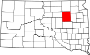 | |
| Towns | ||
| Townships |
| |
| CDPs | ||
| Other communities | ||
| Footnotes | ‡This populated place also has portions in an adjacent county or counties | |