
Caledonia, Wisconsin
Caledonia | |
|---|---|
Village | |
 WIS 32 in Caledonia at 4 Mile Road | |
 Location of Caledonia in Racine County, Wisconsin | |
| Coordinates: 42°48′28″N 87°55′27″W / 42.80778°N 87.92417°W | |
| Country | |
| State | |
| County | Racine |
| Area | |
| • Total | 45.52 sq mi (117.89 km2) |
| • Land | 45.23 sq mi (117.13 km2) |
| • Water | 0.29 sq mi (0.76 km2) 6.75% |
| Elevation | 659 ft (201 m) |
| Population (2020) | |
| • Total | 25,361 |
| • Density | 558.90/sq mi (215.80/km2) |
| Time zone | UTC-6 (CST) |
| • Summer (DST) | UTC-5 (CDT) |
| ZIP Code | 53108 |
| Area code | 262 |
| FIPS code | 55-11950[2] |
| GNIS feature ID | 1582904[3] |
| Website | http://www.caledoniawi.com |
Caledonia is a village in Racine County, Wisconsin, United States. The population was 25,361 at the 2020 census. The residential community of Franksville is located within the village. Franksville is a former census-designated place. The residential neighborhood of Husher is also located within the village. The lakeside community of Tabor is also in the village.
History[edit]
Prior to January 2006, Caledonia was a town. After the state government denied Caledonia's request to become a village, the state legislature enacted a special exemption, allowing Caledonia to proceed. A referendum in 2005 allowed Caledonia to become a village.[5]
Geography[edit]

According to the United States Census Bureau, the village has a total area of 48.72 square miles (126.18 km2), of which, 45.43 square miles (117.66 km2) is land and 3.29 square miles (8.52 km2) is water.[6]
Demographics[edit]
| Census | Pop. | Note | %± |
|---|---|---|---|
| 1980 | 20,940 | — | |
| 1990 | 20,999 | 0.3% | |
| 2000 | 23,614 | 12.5% | |
| 2010 | 24,705 | 4.6% | |
| 2020 | 25,361 | 2.7% | |
| U.S. Decennial Census[7] | |||
2010 census[edit]
As of the census[8] of 2010, there were 24,705 people, 9,629 households, and 7,187 families living in the village. The population density was 543.8 inhabitants per square mile (210.0/km2). There were 10,056 housing units at an average density of 221.4 per square mile (85.5/km2). The racial makeup of the village was 91.7% White, 2.8% African American, 0.4% Native American, 1.8% Asian, 1.5% from other races, and 1.8% from two or more races. Hispanic or Latino people of any race were 5.3% of the population.
There were 9,629 households, of which 31.1% had children under the age of 18 living with them, 63.6% were married couples living together, 7.0% had a female householder with no husband present, 4.1% had a male householder with no wife present, and 25.4% were non-families. 20.3% of all households were made up of individuals, and 8.4% had someone living alone who was 65 years of age or older. The average household size was 2.55 and the average family size was 2.94.
The median age in the village was 43.5 years. 22.6% of residents were under the age of 18; 6.5% were between the ages of 18 and 24; 23.2% were from 25 to 44; 33.3% were from 45 to 64; and 14.4% were 65 years of age or older. The gender makeup of the village was 49.7% male and 50.3% female.
2000 census[edit]
As of the census[2] of 2000, there were 23,614 people, 8,549 households, and 6,805 families living in the town. The population density was 519.1 people per square mile (200.4/km2). There were 8,839 housing units at an average density of 194.3 per square mile (75.0/km2). The racial makeup of the town was 94.18% White, 1.99% African American, 0.42% Native American, 1.27% Asian, 0.05% Pacific Islander, 0.91% from other races, and 1.18% from two or more races. Hispanic or Latino people of any race were 3.12% of the population.
There were 8,549 households, out of which 36.7% had children under the age of 18 living with them, 69.4% were married couples living together, 7.2% had a female householder with no husband present, and 20.4% were non-families. 16.1% of all households were made up of individuals, and 5.5% had someone living alone who was 65 years of age or older. The average household size was 2.71 and the average family size was 3.04.
In the town the population was spread out, with 26.0% under the age of 18, 6.5% from 18 to 24, 30.0% from 25 to 44, 26.7% from 45 to 64, and 10.8% who were 65 years of age or older. The median age was 38 years. For every 100 females, there were 99.8 males. For every 100 females age 18 and over, there were 97.8 males.
The median income for a household in the town was $61,647, and the median income for a family was $68,043. Males had a median income of $46,939 versus $30,859 for females. The per capita income for the town was $26,031. About 2.1% of families and 3.6% of the population were below the poverty line, including 3.1% of those under age 18 and 10.0% of those age 65 or over.
Education[edit]
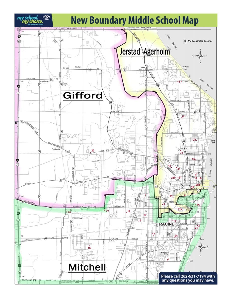
Caledonia is part of Racine Unified School District.[9] Schools serving sections of Caledonia for elementary school, all in Caledonia, include Gifford K–8 School, Olympia Brown Elementary School, and North Park Elementary School.[10] K–8 schools serving sections for middle school include Gifford K–8 and Jerstad-Agerholm K–8 School, the latter in Racine.[11] Senior high schools serving sections of Caledonia include J.I. Case High School in Mount Pleasant and Horlick High School in Racine.[12] Previously Gilmore Middle School in Racine served a section of Caledonia.[13] The R.E.A.L. School in Sturtevant and Walden III Green School in Racine are magnet 6–12 schools serving the area.[14]
Religious private schools in the area include Saint Rita School (K–8) of the Roman Catholic Archdiocese of Milwaukee, in Caledonia; and Trinity Lutheran School (K–8) in Racine.[14]
Secession movement[edit]
There has been an effort to separate into a local independent school district since 2008, culminating in a referendum in April, 2015, which narrowly passed, asking the village to pursue the feasibility of a separation.
Before the referendum, Caledonia's state senator, Van H. Wanggaard suggested that changes could be made to state law which would enable Caledonia (and the village of Sturtevant, which also passed a referendum to pursue separation) to legally separate from the school district. Instead, Wanggaard, along with State Representative Tom Weatherston, proposed that the school district should be divided into territorial districts, rather than electing all of its members to at-large seats. That measure passed into law in Wisconsin's 2015 budget, and the districts adopted ensure that Caledonia and Sturtevant will each have at least one school board representative. "I see this as a better solution than busting Unified up with Caledonia, Sturtevant and Mount Pleasant leaving it," Weatherston said.[15]
However, the issue was not completely settled. In 2017, the Republican state government passed, as part of the biennial budget, the Opportunity Schools and Partnership Program (OSPP). Under the program, if a school district received a failing grade from the state for two consecutive years, a special commissioner would be appointed to draw a new district for the failing schools, and municipalities within the existing district would be empowered to hold a binding referendum on separation from the district. There were no public hearings on the OSPP.[16]
In 2017, however, Racine Unified School District received a passing grade, meaning that a referendum on separation would not be possible under the law until 2020 at the earliest.[17]
In 2018, the Wisconsin Department of Public Instruction and State Superintendent Tony Evers—who was also, at the time, the Democratic candidate for Governor of Wisconsin—recommended the full repeal of the Opportunity Schools and Partnership Program.[18][19] Evers won the 2018 election and became the 46th Governor of Wisconsin.
Notable people[edit]
- Marcel Dandeneau (1931–2017), Wisconsin teacher and state legislator, lived in Caledonia; he served on the Caledonia town board and as chairman of the town board[20]
See also[edit]
References[edit]
- ^ "2019 U.S. Gazetteer Files". United States Census Bureau. Retrieved August 7, 2020.
- ^ a b "U.S. Census website". United States Census Bureau. Retrieved January 31, 2008.
- ^ "US Board on Geographic Names". United States Geological Survey. October 25, 2007. Retrieved January 31, 2008.
- ^ "Population and Housing Unit Estimates". United States Census Bureau. May 24, 2020. Retrieved May 27, 2020.
- ^ "State's Largest Town Passes Referendum, Becomes Village of Caledonia". Archived from the original on July 8, 2015. Retrieved July 7, 2015.
- ^ "US Gazetteer files 2010". United States Census Bureau. Archived from the original on July 2, 2012. Retrieved November 18, 2012.
- ^ "Census of Population and Housing". Census.gov. Retrieved June 4, 2015.
- ^ "U.S. Census website". United States Census Bureau. Retrieved November 18, 2012.
- ^ "Official Map of the Village of Caledonia" (PDF). Caledonia. Retrieved December 7, 2019. - Compare this map to the school district attendance boundary maps.
- ^ "Elementary School Boundaries" (PDF). Racine Unified School District. Retrieved July 2, 2019. // also: "GRADES K - 5 BOUNDARY AREA MAP" (PDF). Racine Unified School District. Retrieved July 2, 2019.
- ^ "Grades 6-8 Boundary Areas Map" (PDF). Racine Unified School District. Retrieved July 2, 2019. // See also: "New Boundary Middle School Map". Racine Unified School District. Retrieved July 2, 2019.
- ^ "High School Boundaries" (PDF). Racine Unified School District. Retrieved July 2, 2019. // also: "High School Boundary Areas Map" (PDF). Racine Unified School District. Retrieved July 2, 2019.
- ^ "Middle School Boundaries" (PDF). Racine Unified School District. Retrieved July 2, 2019.
- ^ a b "Caledonia Schools Overview". Village of Caledonia. Retrieved December 7, 2019.
- ^ Schaaf, Mark (May 20, 2015). "State legislature eyes changing Unified board, related to separation movement". Racine Journal Times. Retrieved February 23, 2019.
- ^ Torres, Ricardo (September 14, 2017). "Assembly passes budget including Unified secession provision". Racine Journal Times. Retrieved February 23, 2019.
- ^ Spoto, Cara (November 27, 2017). "Unified has more work to do, village reps say". Racine Journal Times. Retrieved February 23, 2019.
- ^ Torres, Ricardo (September 23, 2018). "DPI asks to fully repeal OSPP". Racine Journal Times. Retrieved February 23, 2019.
- ^ Torres, Ricardo (September 23, 2018). "Local officials, candidates respond to OSPP proposal". Racine Journal Times. Retrieved February 23, 2019.
- ^ 'Wisconsin Blue Book 1977,' Biographical Sketch of Marcel Dandeneau, pg. 63
External links[edit]
Municipalities and communities of Racine County, Wisconsin, United States | ||
|---|---|---|
| Cities |  | |
| Villages | ||
| Towns | ||
| CDPs | ||
| Other communities | ||
| Former communities | ||
| Footnotes | ‡This populated place also has portions in an adjacent county or counties | |
| Central city |  | |
|---|---|---|
| Largest municipalities (over 25,000 in 2010) | ||
| Municipalities (over 10,000 in 2010) | ||
| Smaller municipalities (under 10,000 in 2010) |
| |
| Counties | ||
| Other topics | ||