Geography of Niue
This article needs additional citations for verification. (April 2019) |

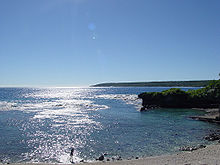
Niue is a small, oval island in the South Pacific Ocean, to the east of Tonga. It has an area of 260 square kilometres, and a coastline of 64 km. It claims an exclusive economic zone of 200 nautical miles, and a territorial sea of 12 nautical miles. It is one of world's largest coral islands.
Climate[edit]
Niue's climate is tropical, modified by south-east trade winds. Cyclones pose a natural hazard.
| Climate data for Alofi | |||||||||||||
|---|---|---|---|---|---|---|---|---|---|---|---|---|---|
| Month | Jan | Feb | Mar | Apr | May | Jun | Jul | Aug | Sep | Oct | Nov | Dec | Year |
| Record high °C (°F) | 38 (100) |
38 (100) |
32 (90) |
36 (97) |
30 (86) |
32 (90) |
35 (95) |
37 (99) |
36 (97) |
31 (88) |
37 (99) |
36 (97) |
38 (100) |
| Mean daily maximum °C (°F) | 28 (82) |
29 (84) |
28 (82) |
27 (81) |
26 (79) |
26 (79) |
25 (77) |
25 (77) |
26 (79) |
26 (79) |
27 (81) |
28 (82) |
27 (81) |
| Daily mean °C (°F) | 26 (79) |
27 (81) |
26 (79) |
25 (77) |
25 (77) |
23 (73) |
22 (72) |
23 (73) |
23 (73) |
24 (75) |
25 (77) |
26 (79) |
25 (77) |
| Mean daily minimum °C (°F) | 23 (73) |
24 (75) |
24 (75) |
23 (73) |
22 (72) |
21 (70) |
20 (68) |
20 (68) |
21 (70) |
21 (70) |
22 (72) |
23 (73) |
22 (72) |
| Record low °C (°F) | 20 (68) |
20 (68) |
20 (68) |
14 (57) |
15 (59) |
13 (55) |
11 (52) |
11 (52) |
15 (59) |
15 (59) |
11 (52) |
17 (63) |
11 (52) |
| Average precipitation mm (inches) | 261.6 (10.30) |
253.6 (9.98) |
305.6 (12.03) |
202.6 (7.98) |
138.2 (5.44) |
88.9 (3.50) |
96.4 (3.80) |
105.8 (4.17) |
102.4 (4.03) |
123.8 (4.87) |
145.5 (5.73) |
196.2 (7.72) |
2,018.4 (79.46) |
| Source: Weatherbase[1] | |||||||||||||
Terrain[edit]

The terrain consists of steep coastal cliffs made from limestone and a central plateau. Scenic features on the northern coast are the Talava Arches. The three sea arches are accessible via a trail. Further west on the coast the user will encounter Avaiki Cave.

The coastline also includes numerous coastal caverns including Ana, Togo, and Vaikona. The lowest point is at sea level, and the highest is an unnamed point near Mutalau settlement, at 68 m.
Natural resources[edit]
The island's natural resources are fish and arable land. Land use in 1993 was as in the following table:
| Use | Percentage of area |
|---|---|
| arable land | 19 |
| permanent crops | 8 |
| permanent pastures | 4 |
| forests and woodland | 19 |
| other | 50 |
Environmental issues[edit]
A current environmental issue is increasing attention to conservationist practices to counter loss of soil fertility from traditional slash-and-burn agriculture. Niue is a party to the following international agreements regarding the environment: Biodiversity, Climate Change-Kyoto Protocol, Desertification. Niue has signed but not ratified the Law of the Sea agreement.
Boundaries[edit]
Niue has signed a treaty with the United States in which the parties delimited the east–west maritime boundary between Niue and American Samoa. Niue is south of American Samoa.
Extreme points[edit]
This is a list of the extreme points of Niue, the points that are farther north, south, east or west than any other location.
- Northernmost point – unnamed headland north-west of Uluvehi
- Easternmost point – unnamed headland south-east of Liku
- Southernmost point – Limufuafua Point
- Westernmost point - Halagigie Point
References[edit]
- ^ "Weatherbase: Historical Weather for Alofi, Niue". Weatherbase. Retrieved 3 August 2009.
19°02′S 169°52′W / 19.033°S 169.867°W![]() This article incorporates public domain material from The World Factbook. CIA.
This article incorporates public domain material from The World Factbook. CIA.
External links[edit]
