
Pont-de-Chéruy
You can help expand this article with text translated from the corresponding article in French. (December 2009) Click [show] for important translation instructions.
|
Pont-de-Chéruy | |
|---|---|
 A general view of Pont-de-Chéruy | |
 Coat of arms | |
Location of Pont-de-Chéruy  | |
 Pont-de-Chéruy  Pont-de-Chéruy | |
| Coordinates: 45°45′05″N 5°10′25″E / 45.7514°N 5.1736°E | |
| Country | France |
| Region | Auvergne-Rhône-Alpes |
| Department | Isère |
| Arrondissement | La Tour-du-Pin |
| Canton | Charvieu-Chavagneux |
| Government | |
| • Mayor (2020–2026) | Franck Bron[1] |
| Area 1 | 2.51 km2 (0.97 sq mi) |
| Population (2021)[2] | 6,096 |
| • Density | 2,400/km2 (6,300/sq mi) |
| Time zone | UTC+01:00 (CET) |
| • Summer (DST) | UTC+02:00 (CEST) |
| INSEE/Postal code | 38316 /38230 |
| Elevation | 196–236 m (643–774 ft) |
| 1 French Land Register data, which excludes lakes, ponds, glaciers > 1 km2 (0.386 sq mi or 247 acres) and river estuaries. | |
Pont-de-Chéruy (French pronunciation: [pɔ̃ də ʃeʁɥi]) is a commune in the Isère department in southeastern France.
Geography[edit]
Pont-de-Chéruy is located in the department of Isère and in the region of Auvergne-Rhone-Alps, and is an outer suburb of Lyon. The Bourbre flows north through the middle of the commune and crosses the town.
Population[edit]
The population has evolved according to the following table:
|
| ||||||||||||||||||||||||||||||||||||||||||||||||||||||||||||||||||||||||||||||
| Source: EHESS[3] and INSEE (1968-2017)[4] | |||||||||||||||||||||||||||||||||||||||||||||||||||||||||||||||||||||||||||||||
Health centers and schools[edit]
In 2009 there were 1 medical center and 3 pharmacies.
Since 2009 Pont-de-Chéruy has 2 maternal schools and 1 elementary school, 1 high school and 2 lyceums.
Public and private companies[edit]
Regarding the establishments of services to the population since 2009, there are 1 office of public treasury/tax, 1 unemployment office, 1 police station, 1 post office, various banks, 1 mortuary and multiple private companies of industrial, agricultural, catering and real estate services.[5]
Image gallery[edit]
-
 Grammont castle
 -
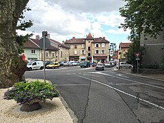 Square


Twin towns[edit]
Pont-de-Chéruy is twinned with:
 Bucha, Ukraine, since 2016[6]
 Livorno Ferraris, Italy, since 2001
See also[edit]
References[edit]
- ^ "Répertoire national des élus: les maires". data.gouv.fr, Plateforme ouverte des données publiques françaises (in French). 2 December 2020.
- ^ "Populations légales 2021". The National Institute of Statistics and Economic Studies. 28 December 2023.
- ^ Des villages de Cassini aux communes d'aujourd'hui: Commune data sheet Pont-de-Chéruy, EHESS (in French).
- ^ Population en historique depuis 1968, INSEE
- ^ "Number of equipments des services aux particuliers". INSEE (in French).
- ^ "Міста-побратими | Офіційний сайт Бучанської міської ради". bucha-rada.gov.ua (in Ukrainian). Retrieved 25 June 2023.
| International | |
|---|---|
| National | |
This Isère geographical article is a stub. You can help Wikipedia by expanding it. |